
![]()
|
|
||||||
|
||||||
|
The Famouse Builders Bum Tee shirt
Select a country to Design your own Surf wear |
||||||
|
|
||||||
|
|
||||||
|
|
||||||
|
|
||||||
|
|
||||||
|
|
||||||
|
|
||||||
|
|
||||||
 |


|
You
dont need a PayPal account to order .
|
||
 |
||
 |
||
|
|
||
|
|
||


|
Surf
Clothing Surf Forecast Surf Photos Surf Webcams Surf Schools Surf
accomodation for Porthcurno
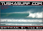
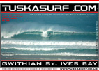
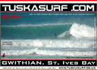
- Gwithian
Surf
St. Ives Surf- Porthtowan - Portreath
Cornwall England UK
|
 |
 |
 |
|
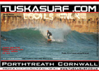
PORTHTREATH1
|
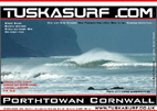
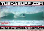
PORTHTOWAN1
|
PORTHTOWAN2
|
 |
 |
 |
|
|
|
|
 |
 |
 |
|
|
|
|
 |
 |
|
|
|
||
|
All Photos copyright of The website for info on accomadation in this are |
||

|
Weather
Forecast St.IVES 10 Days-Map-3 Hour Detail
|
||||||||||||||||||
|
||||||||||||||||||
|
SURF
WEBCAMS
|
||||||||||||||||||
|
||||||||||||||||||
|
||||||||||||||||||
|
||||||||||||||||||
|
||||||||||||||||||
|
||||||||||||||||||
|
SURFING FORECASTS All the best Surf Forecasts for your surf all in One Place
Atlantic Pressure Charts Dailey North Atlantic Satellite Image below.
HOW TO PREDICT A SWELL FROM WEATHER CHARTS Look for
a storm and verify it will be in your swell window. A 'swell
window' is the part of your ocean that provides a swell |
||||||||||||||||||
|
Surf Clothing Surf Forecast Surf Photos Surf Webcams Surf Schools Surf accomodation for Porthcurno - Gwithian Surf St. Ives Surf- Porthtowan - Portreath Cornwall England UK All the best Surf forecasts and surf webcam all in one place. |
||||||||||||||||||


|
||||||||||
|
Surf
Clothing from all over the World. Copyright © 2008 Tuska Surf
Co. All Rights Reserved
|


